


The greatest hurdle to completing the Pacific Crest Trail may no longer be the physical challenge of traveling its 2,650 miles. Not only is scoring a permit for the thru-hike nearly impossible these days, but completing the trail can also cost $10,000 or more. For aspiring thru-hikers tired of high costs and fighting for permits, the Midwest offers a smart alternative.
This overlooked region is home to many thru-hikes that deliver on the natural beauty and physical challenge backpackers are looking for. But they also avoid many of the logistical or financial obstacles that come with popular thru-hikes on the coasts.
For newbies, there are trails about 100 miles long that serve as a great introduction to long-distance backpacking. And, for those veterans looking to spend months in the backcountry, there are several 1,000-mile hikes that’ll scratch that itch. Check out the best hikes of the Midwest below, and find tips and tricks for each trail.
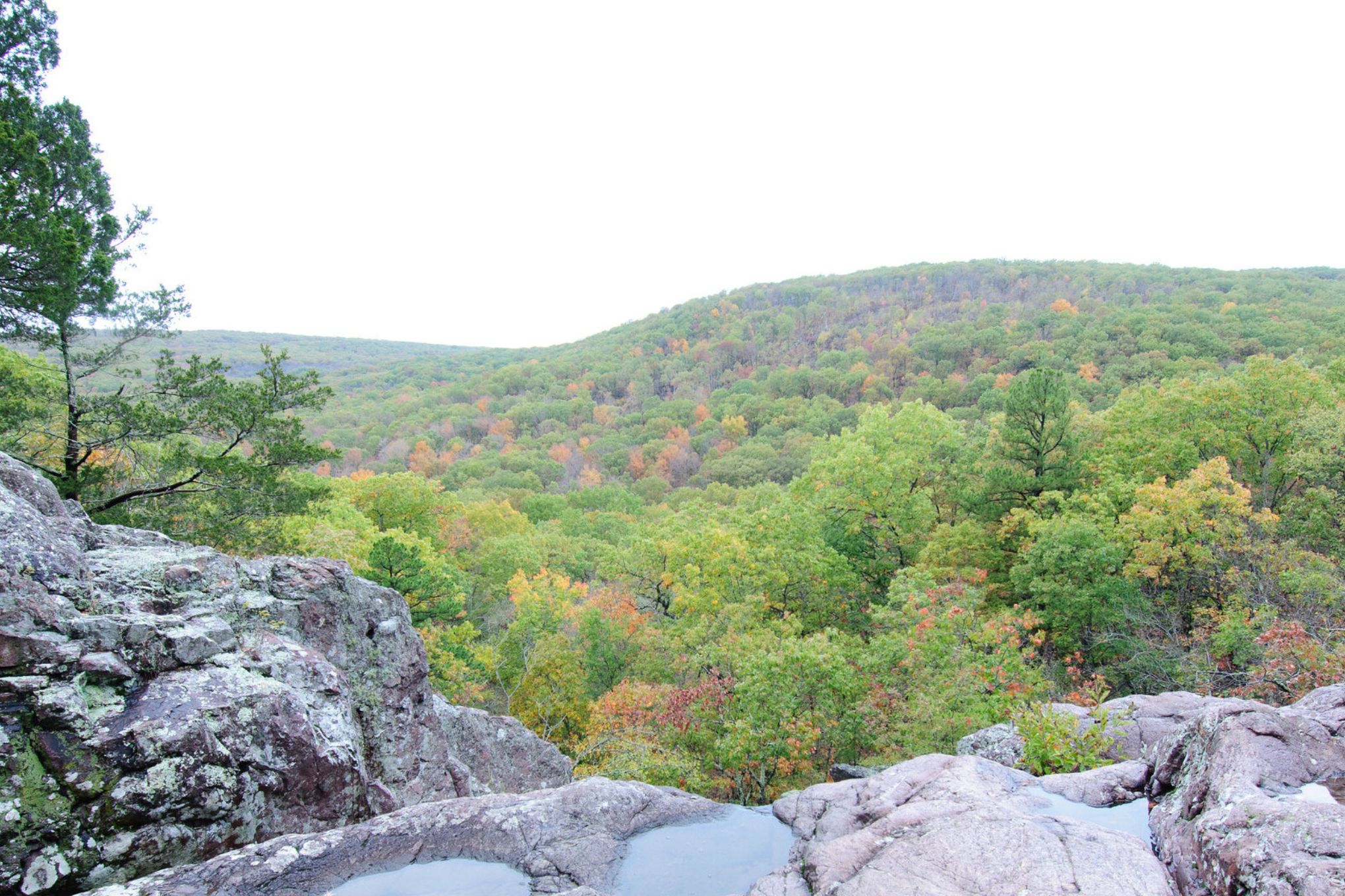
Ozark Trail
This Missouri-based thru-hike is still in development, with the planned mileage totaling over 450 miles. The longest continuous stretch currently is 230 miles: plenty long enough to satisfy a hiker with backcountry dreams.
The Ozark Trail passes through some of Missouri’s most scenic areas, including Mark Twain National Forest. Other highlights include Taum Sauk State Park (the highest point in Missouri at 1,772 feet) and Johnson’s Shut-Ins State Park, home to a series of natural pools and waterfalls.
If worrying about getting a campsite isn’t your thing, the Ozark Trail (OT) will be a welcome respite. Free dispersed camping is allowed along the route, provided that hikers camp 300 feet from developed sites and 100 feet from water sources.
Things to Know
- The OT doesn’t run directly through any towns. To resupply along the way, hikers will have to make slight detours to nearby towns or make other arrangements.
- Missouri can be rife with ticks and chiggers (microscopic bugs that cause severe itching) in the spring and summer. To avoid these pests, fall is the best season for this thru-hike.
- Be aware that parts of the trail from Current River to the Eleven Point River may be closed in the spring due to turkey hunting season.
- Check out the Ozark Trail Association for updates on trail conditions.
Superior Hiking Trail
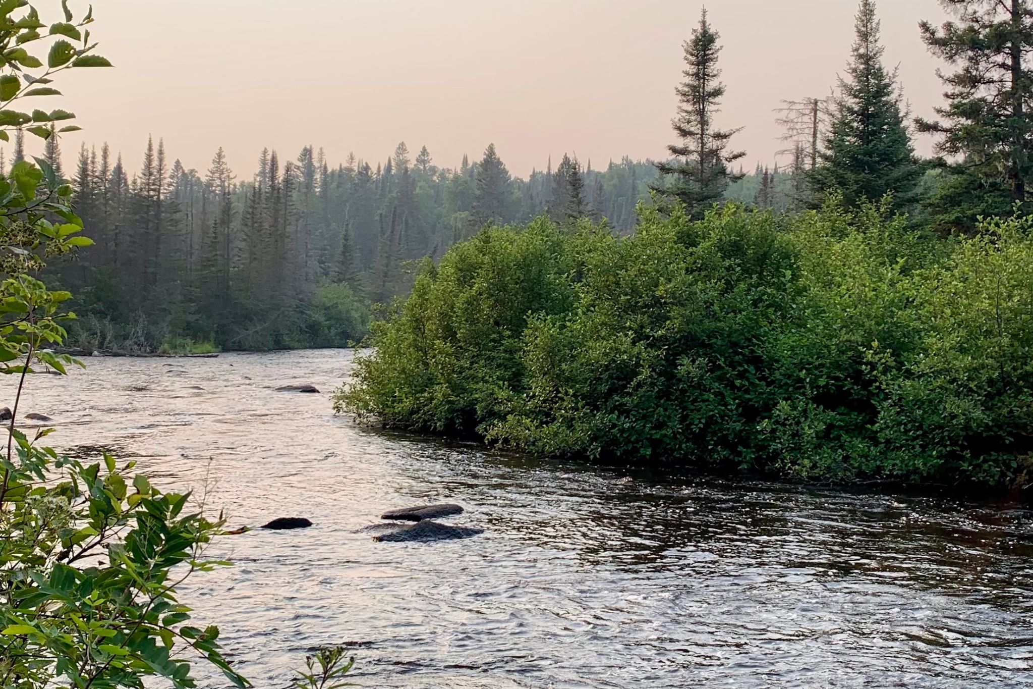
Minnesotans know that the North Shore along Lake Superior is one of the most beautiful parts of the state. It’s so spectacular that outdoor enthusiasts came together in 1986 to form the Superior Hiking Trail Association and establish a thru-hike in the area. The result, the Superior Hiking Trail (SHT), is a 300-mile hike that starts in Duluth and ends just before the Canadian border.
The SHT is extremely well way-marked, with blazes and signage aplenty. There are 94 free, designated backcountry campsites along the entirety of the route every few miles, making it easy to customize your itinerary. No permits, fees, or reservations are required for this thru-hike.
If your favorite part of fall is the stunning foliage, this is the trail for you. Aspen, maple, and birch trees in the Superior National Forest transform into a colorful symphony during autumn. Be sure to take your time to explore Cascade River State Park, home to a series of striking waterfalls and scenic river vistas.

Things to Know
- The Superior Hiking Trail Association sells a detailed guidebook and section maps on its website, where you can also find trail condition updates.
- While not widespread, black bears have been spotted on the trail. All backpackers should bring an approved bear canister. Other wildlife hikers might spot include moose, foxes, and beavers.
- Instead of steep ascents and descents, the SHT’s elevation changes resemble rolling hills. Elevation change is frequent, but not drastic. The highest point on the trail is 1,829 feet, and the lowest point is 602 feet.
Ice Age National Scenic Trail
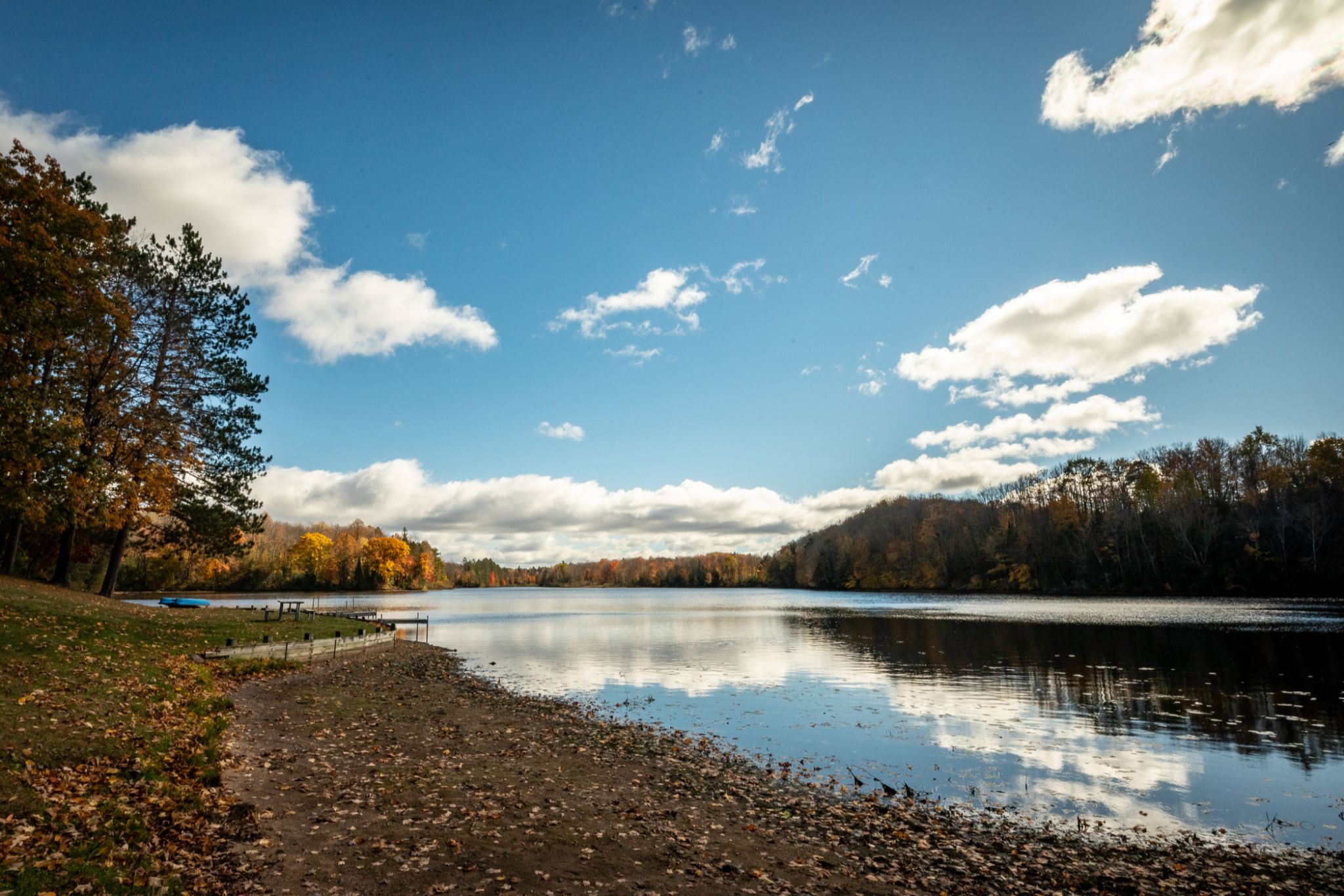
Wisconsin’s Ice Age Trail runs 1,200 miles across the state and is one of only 11 National Scenic Trails in the country. Significant portions of the trail hug Lake Michigan’s shoreline, making for a scenic accompaniment and convenient water source. The hike takes backpackers to many of Wisconsin’s state parks, including Brunet Island, Potawatomi, and Devil’s Lake.
If you like a dose of history and small-town charm with your travels, the Ice Age Trail is a great choice. The trail passes by several historic and cultural sites, including Washington House (where the ice cream sundae was invented in 1881), the Rotary Botanical Gardens, and the Two Rivers Museum.
Its path through many small towns makes it easy to resupply and get a hearty, home-cooked meal — a welcome sight after weeks of ramen and trail mix.
Camping along the trail does take some logistical forethought. There are four kinds of camping along the trail: primitive camping and dispersed camping areas, which do not charge fees, and backpacking campgrounds and traditional developed campgrounds, which often charge fees and require reservations.
Find more information from the Ice Age Trail Alliance, which sells guidebooks, maps, and atlases on its website.

Things to Know
- While state parks stay open to hikers during hunting seasons, thru-hikers should be aware of these dates and take precautions.
- ColdCaching, a kind of geocaching that involves spotting natural features instead of geocache boxes, is common on the trail. There are over 80 ColdCache sites; locate them to gain a better appreciation of the state’s landscape.
Centennial Trail
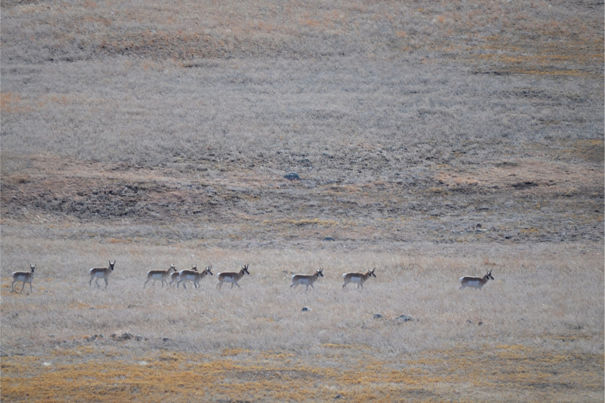
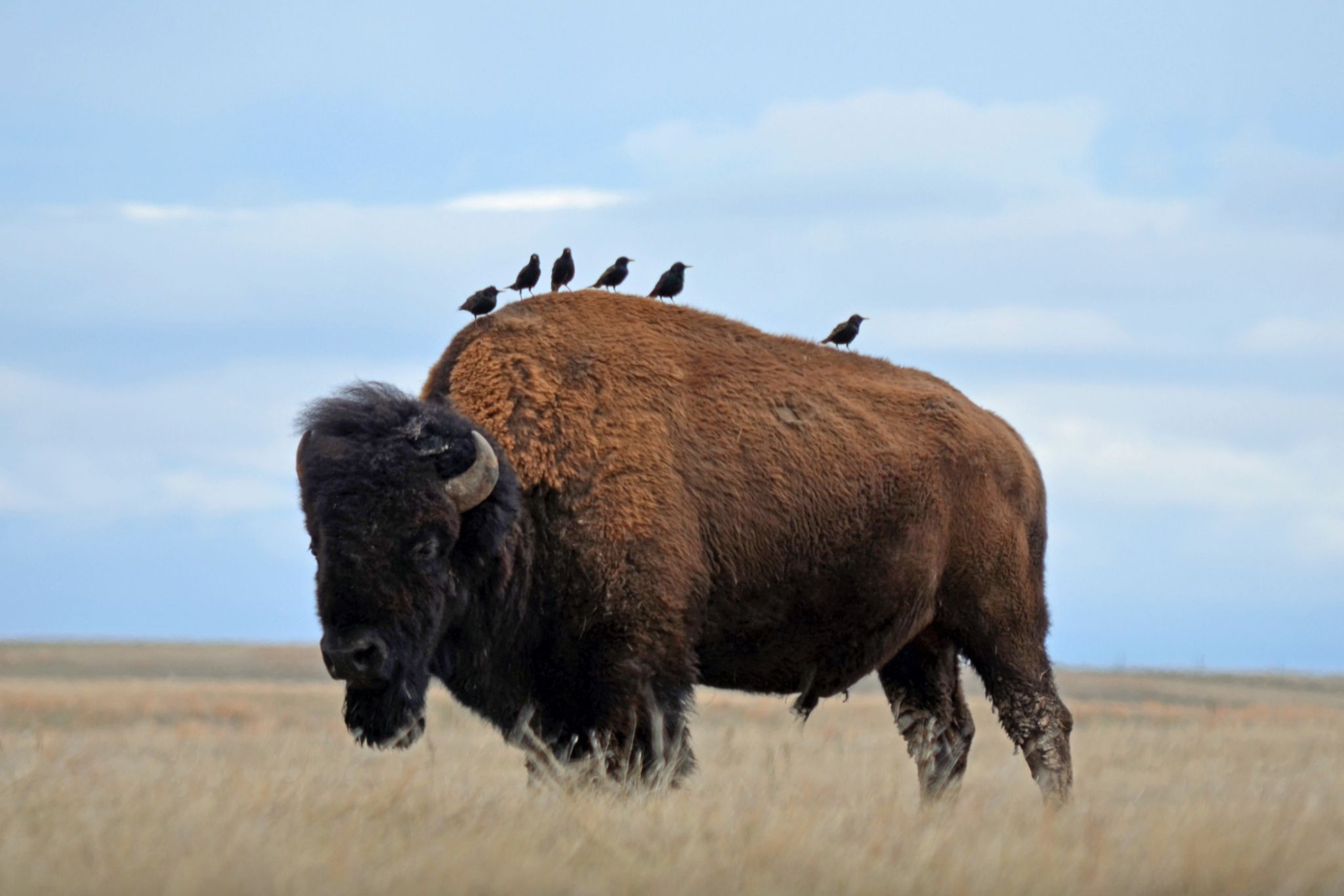
With sprawling forests and impressive peaks, South Dakota’s Black Hills region is one of the Midwest’s true wild gems. Explore it fully on the Centennial Trail (CT), a 123-mile thru-hike that showcases many state and federal natural areas.
Highlights include Black Elk Peak, the highest natural point in the Midwest, Wind Cave National Park, home to one of only four natural, free-roaming bison herds in the country, and Bear Butte, a geological formation sacred to many of the area’s Indigenous peoples. Hikers will cross diverse terrain, ranging from lowland prairies to lush forests to rugged peaks.
In the Black Elk Wilderness, striking granite spires (unique rock formations that characterize the area) will be hikers’ constant companion. In addition to bison, commonly spotted wildlife on the CT include mountain goats, big-horned sheep, antelope, elk, and bald eagles.
Things to Know
- The CT passes through areas controlled by a variety of state and federal agencies. So, camping is a hodgepodge of developed campsites that charge fees and allow reservations, dispersed camping in national forests, and free designated tent camping sites.
- Free backcountry permits are required for the portion of the trail that runs through Wind Cave National Park.
- Some established campgrounds on the trail only turn on drinking water during the summer, making that season your best bet to complete the CT.
River to River Trail
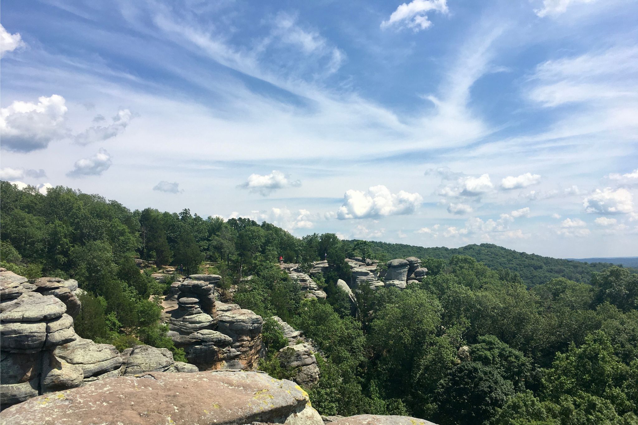
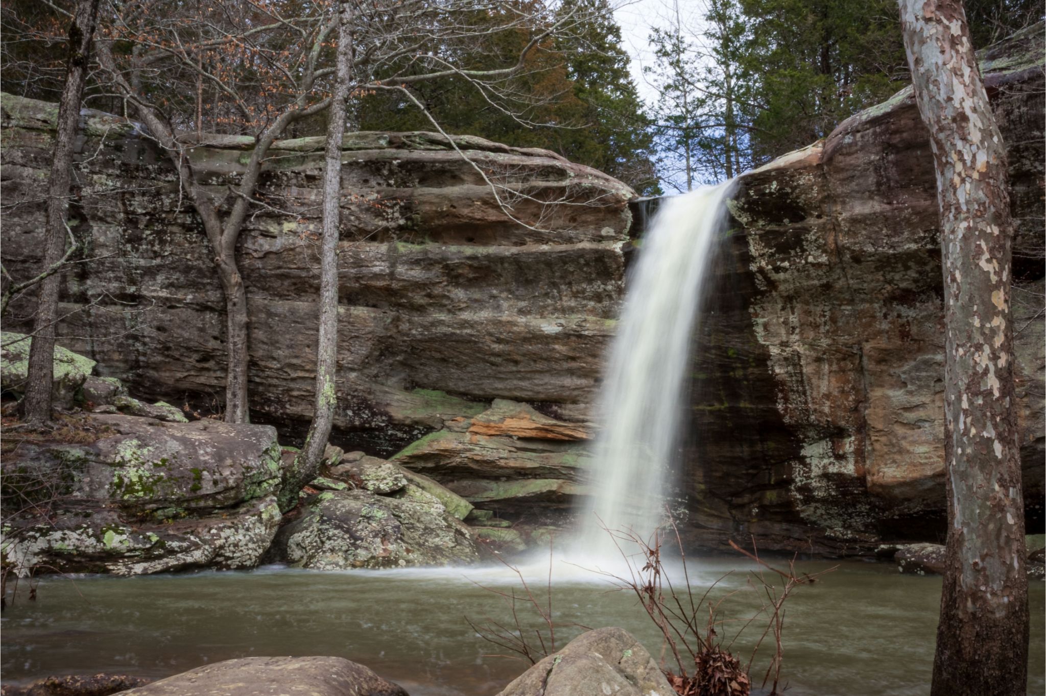
Southern Illinois is one of the most slept-on spots for outdoor adventures. It’s home to Shawnee National Forest, a gorgeous area with sandstone cliffs and expansive lakes that span nearly 300,000 acres. The River to River Trail, which begins near the Ohio River and ends by the Mississippi River, takes hikers through 160 miles of this special landscape.
Take time to savor the Garden of the Gods Recreation Area, where beautiful rock formations stand alongside panoramic views of Shawnee. If the weather’s nice, take a dip in Jackson Falls, a crystal blue pool fed by a gentle waterfall, or Pounds Hollow, a particularly lovely swimming hole. Bald Knob Wilderness, with its large valleys and steep terrain, will give you a true taste of the Ozarks.
Things to Know
- The River to River Trail Society offers a free guide to the trail, along with other resources, on its website.
- This region’s weather can be fickle and rainy in the spring, reach unbearably hot temps in the summer, and get substantial snow in the winter, so embark in the fall for the best experience.
- The towns of Eddyville and Makanda are directly on the trail itinerary, making them great choices for resupplying.
Read the full article here